Example – Distortion Grid
The distortion grid for the sample map clearly visualizes its general rotation of about 16 degrees in clockwise direction. Each mesh corresponds to a surface of 5000 by 5000 meters in the new reference map. If the map had no distortion (or were as accurate as the modern reference map), the grid would be perfectly regular and not rotated. Compressed or enlarged grid cells reflect local distortions in the old map.
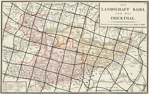
"Die Landschaft Basel und das Frickthal" by W. Haas, 1798, with a distortion grid with a mesh size of 5000 meters.